MacLehose Trail – Stages 9 & 10 – Route Twisk-Tuen Mun

Route Twisk to Tuen Mun (Stage (9 & 10)

Saturday 4th March – 4h 31mins – 24.78km

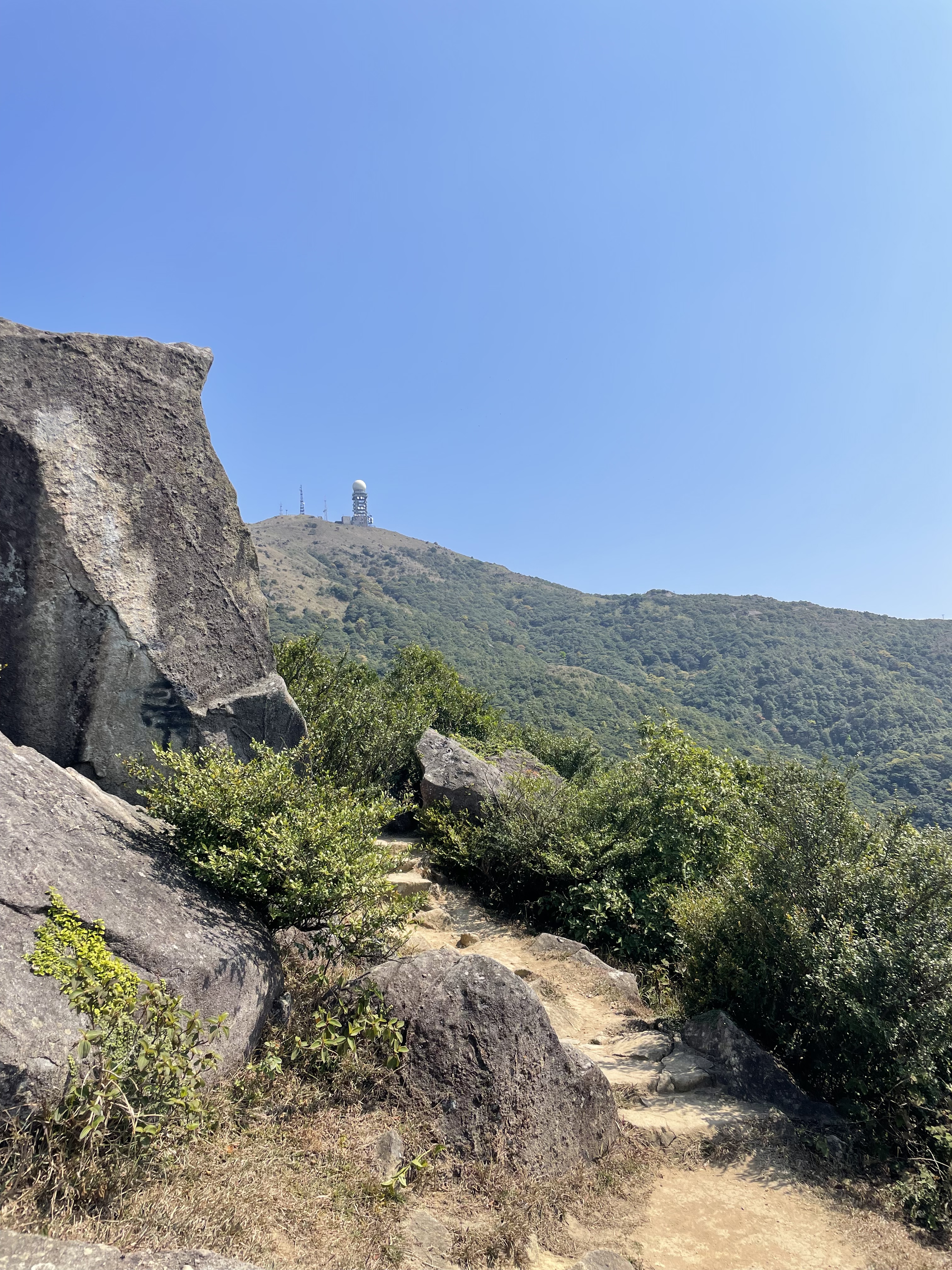
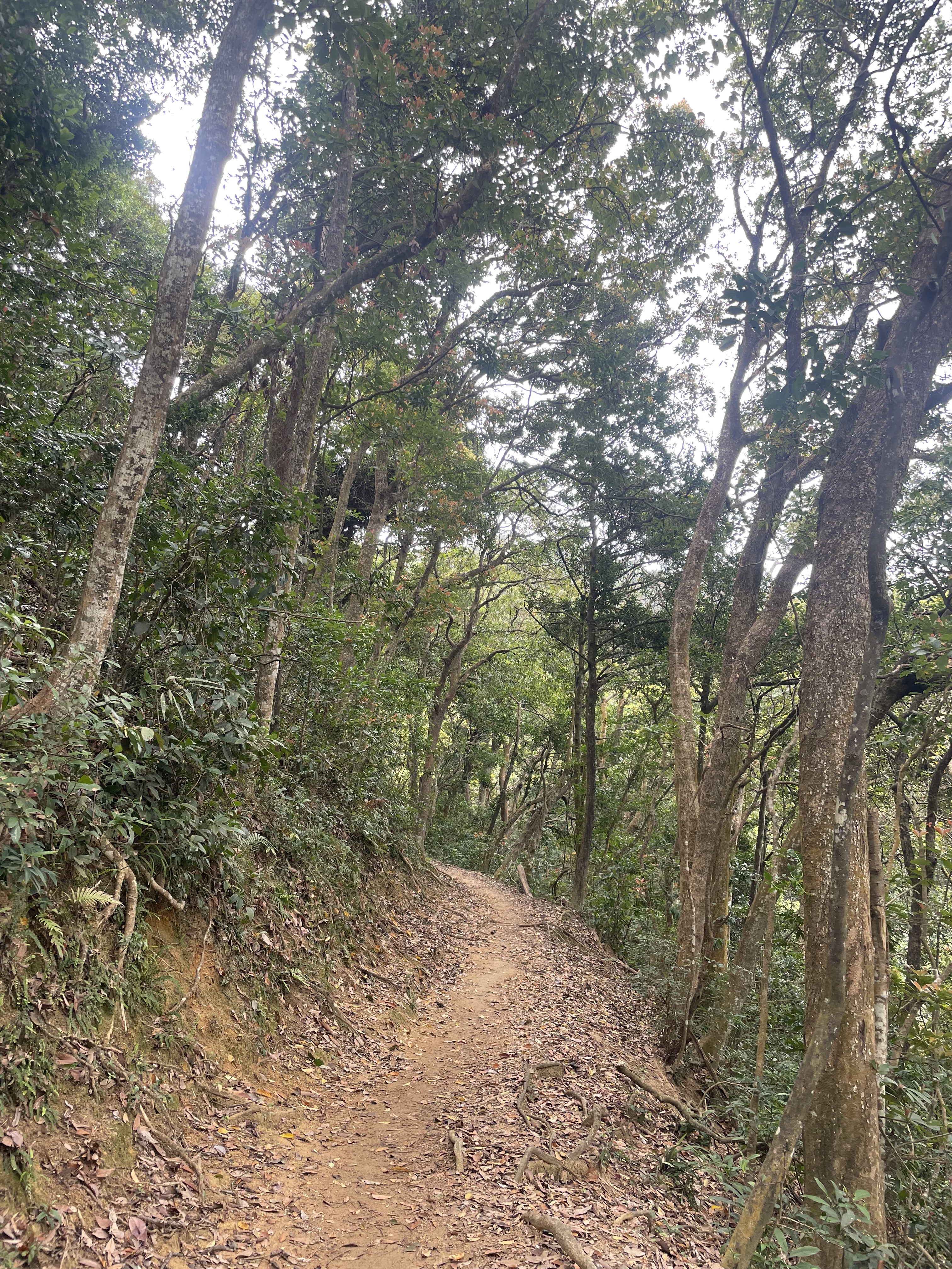
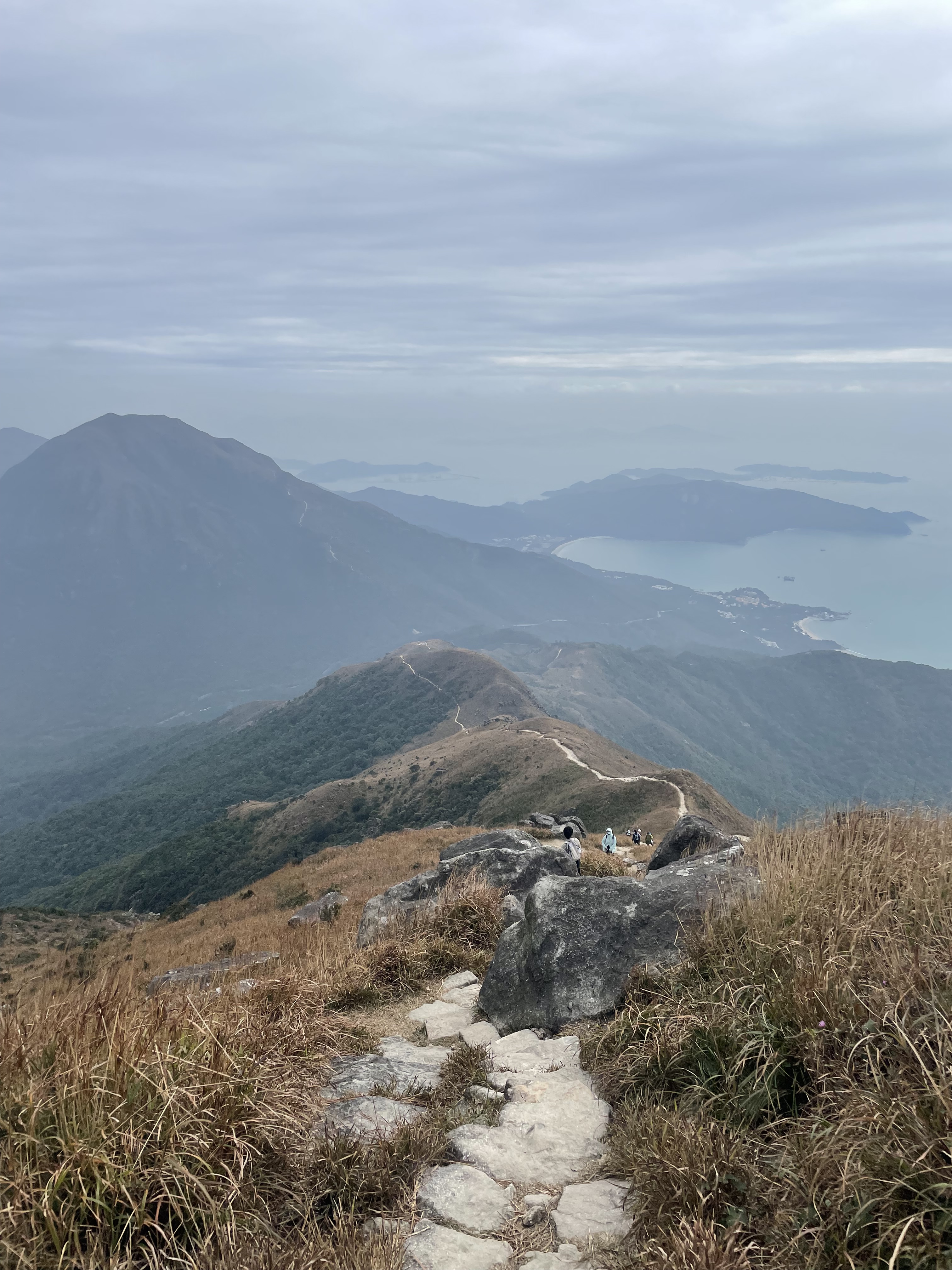
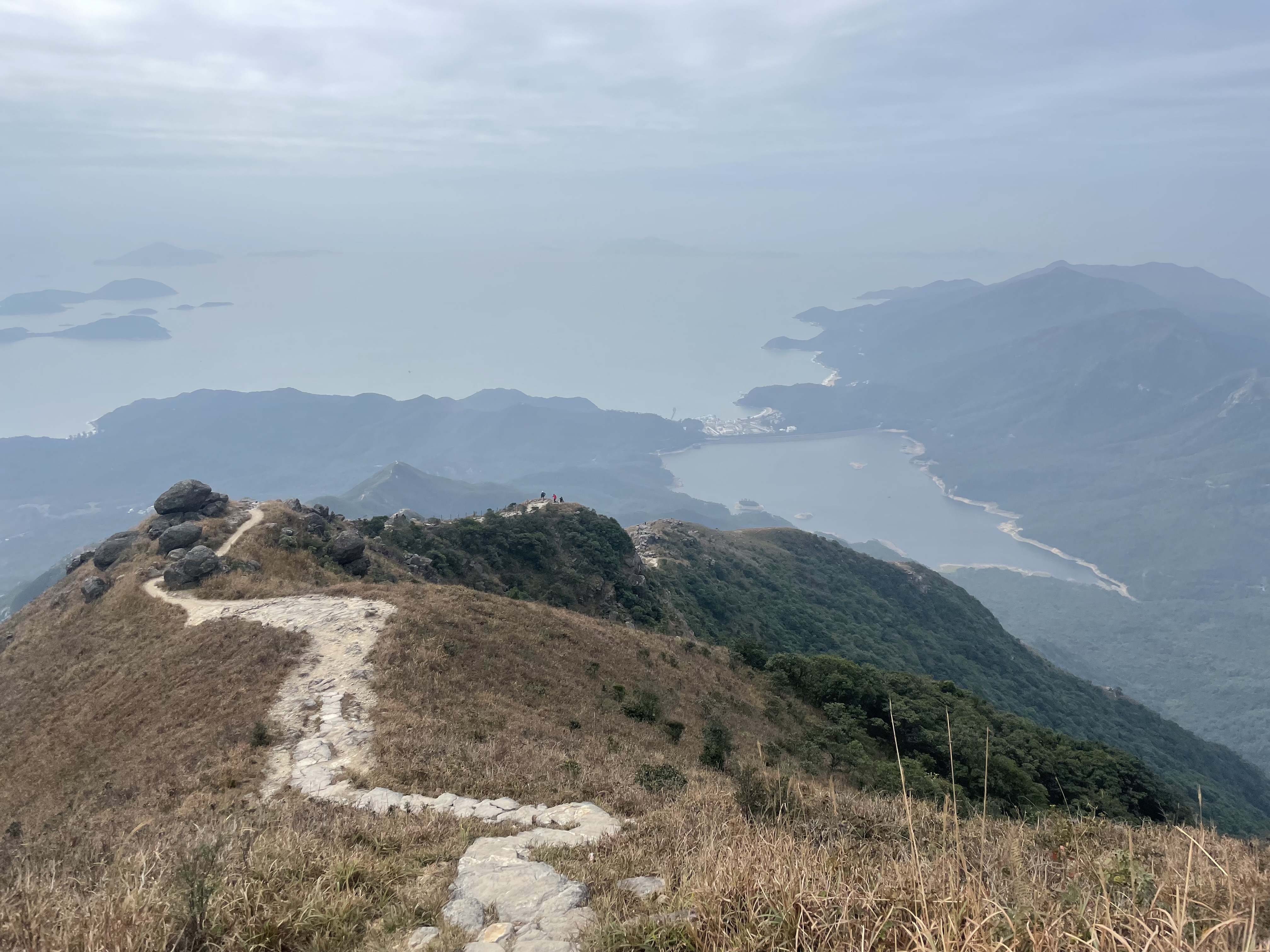
            The final stage, and off up a paved road through thick forest, continuing away from Route Twisk and Tai Mo Shan. To be honest, Stage 9 of the Maclehose Trail is fairly dull, though very sedate, and only every so often are you afforded a view either out across the docks at Tsuen Wan, or out to Yuen Long. The day was hazy, though, so even the scenery was a little disappointing. The trees, though, were a patchwork of greens, yellows and light oranges. Hardly Maine in fall, but unusual for Hong Kong.

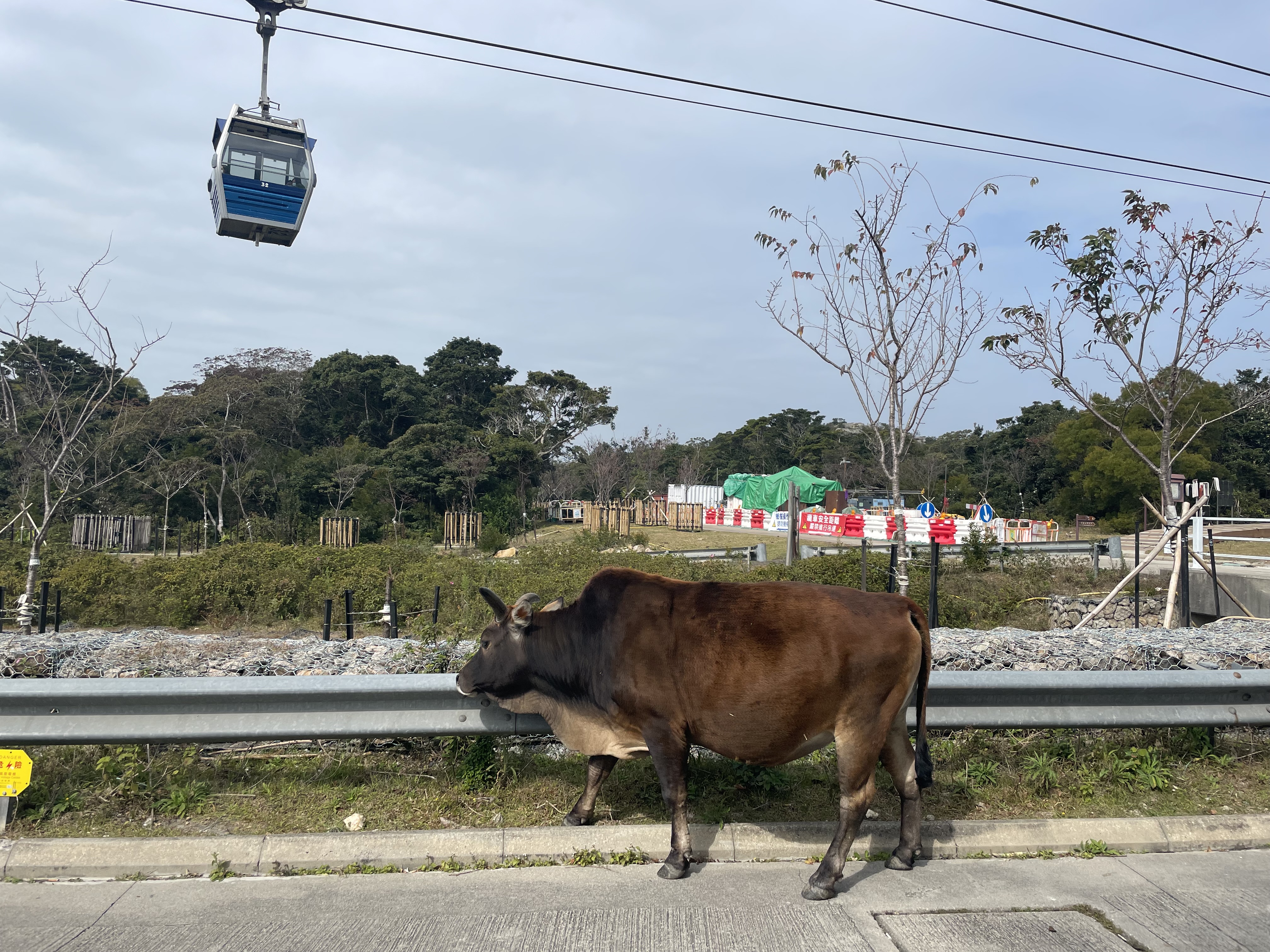
            These roads are also used for mountain biking, and so every so often one would whizz past on the downhill, or plod towards me as the driver struggled with a slope. There were cows too, or at least signs that they were around: the ubiquitous dried pats, and more unusually hooves from long ago imprinted in a stretch of concrete path.

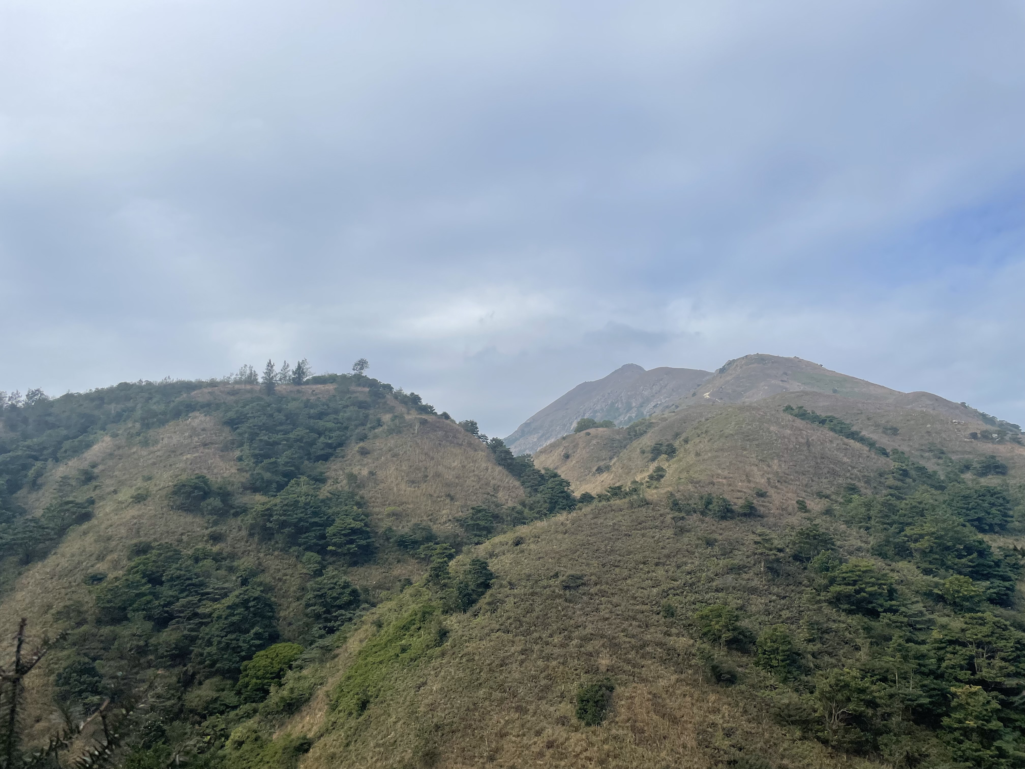
            As the trail transitioned into Stage 10, things became a little more interesting. The path had been winding down towards Tai Lam Chung Reservoir, and it finally turned into a proper trail just after I had passed the Sweet Gum Woods (that are rammed with photographers when the leaves turn in autumn). The steps take you up to a viewing point looking out over the reservoir, that appears to be dotted with hundreds of tiny islands (though most are peninsulas), and past temples dotted on the hillside for travellers going between Tuen Mun and Yuen Long to pray for safe passage, in the days before roads and tunnels.

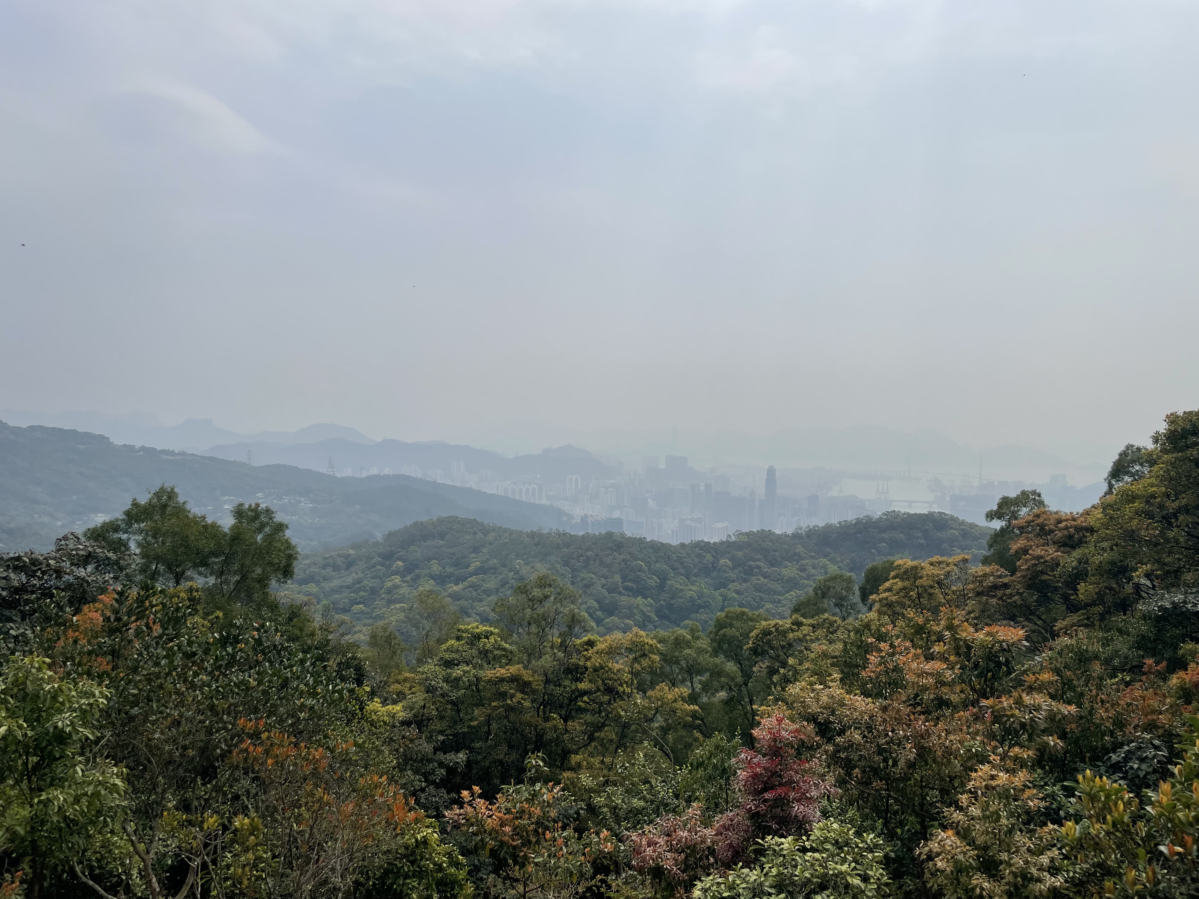
            Soon, though, it was back to paved roads, and a long stretch along a catchwater towards Tuen Mun. I ended up pondering just how many catchwaters I’d walked along on these four trails, and which catchwater is the most picturesque (I think I’d have to say the one on Stage 5 of the Wilson trail, with views of Lion Rock and Amah Rock). In truth, the end of the trail is as much of a dull trudge as the beginning, with the hazy views now out over Gold Coast and the sea beyond melting into the mist.

            Then came Tuen Mun, which is a place I’ve never spent much time in, but which feels a bit like Hong Kong’s wild west: dry and dusty, and a little bit run down. The views down the low hillside were of construction sites and shacks, with Castle Peak an imposing presence on the other side of the river. I briefly wondered why the trail doesn’t end with that peak, one of Hong Kong’s most famous, but by this point my feet and calves were weary and I was glad that we were almost done.

            There was one final cruel climb, before a flight of zig-zagging steps took me down to the city centre, and an inconspicuous end to Hong Kong’s longest trail: a sign and marker next to a bin. My hike ended a few hundred metres further on in the most Hong Kong way possible, over and under various flyovers, at the MTR station.

MacLehose Trail – Stage 8 – Sun Uk Ka-Route Twisk

Sun Uk Ka to Route Twisk (Stage 8)

Thursday 23rd February – 3h 12mins – 13.69km

            With a random Thursday off, and the Trail Walker event likely clogging up the MacLehose Trail the coming weekend, I tackled Hong Kong’s highest peak – Tai Mo Shan.

            ‘Tackled’ is perhaps the wrong word, as a lot of the climb is along very gentle, grassy slopes. But if you start as I did, at the foot of the long path up to Leadmine Pass, perhaps it is the right term. Still it was a glorious morning, and I made the sweaty, uneven climb along a sun-dappled path next to a babbling stream.

            At Leadmine Pass, tents had been set up, all ready for the weekend’s influx (where people attempt what I started back on January 23rd over the course of a single weekend. The steep climb continues here, back on MacLehose, but soon the trees thin out and spectacular views back to Tai Po, Sha Tin, Shing Mun and Kowloon, even the Island. I could pick out almost all the trails I had done this autumn and winter, with the exception of Lantau, which was covered in a fine haze.

            Once the path levels out, you get a landscape seen elsewhere in Hong Kong above a certain height – Sunset and Lantau Peaks and the Pat Sin Leng range spring to mind – one that feels more like a European moor. Huge boulders are strewn at short intervals, presumably from Tai Mo Shan’s days as a volcano, several millennia ago, and small herds of cattle graze lazily by the path. Of all the animals you might encounter on a Hong Kong hike, the buffalo are by far my favourite. Languid chewing and flicking of tails, and barely any acknowledgement as you pass. They own the mountainsides and the beaches, and they know it.

            The summit of Tai Mo Shan, the highest point that you can achieve in the territory at just under a thousand metres, is actually quite foreboding. At the top is a government weather station-slash-satellite facility, surrounded by barbed wire and signs forbidding entry. By this point you are on a road, which makes for a smoother climb, though you can’t actually make the very summit.

            On the other side of the mountain, the road zigzags down, giving you plenty of time to enjoy the panorama of Tsuen Wan on one side, Yuen Long and even Shenzhen on the other, and plenty of time to be blasted by the sun. As I made my way down, planes started flying low overhead, making their final descent towards Chek Lap Kok. This side of the hill was much busier with hikers and cyclists, as cars can drive almost up to the summit, and I spotted that most Asian phenomenon: the pre-wedding photo shoot. In this case the bride and groom (in full dress) were straddling a motorbike with Tai Mo Shan as the backdrop.

            Soon after that the trail leaves the road, and the remainder of the hike is down a fairly mundane path to Route Twisk and a bus that was only six minutes away. And all of a sudden I was just one hike away from finishing the MacLehose, and the Big Four.

MacLehose Trail – Stage 6 & 7 – Tai Po Road-Sun Uk Ka

Tai Po Road – Sun Uk Ka (Stage 6 & 7)

Saturday 18th February – 3h 18mins – 15km

            Finally I had a clear day, and started up the road past Shek Pui and the Kowloon reservoirs, towards the exotically named Smugglers’ Ridge. This is a prime monkey country, and I’ve had some hair-raising experiences in the past making my way through swarms of them. Today there were only a few around, lazily grooming one another on the concrete verges of the road.

            At the top of the slope, you can look back towards the towers of Kowloon, and in particular the ICC, Hong Kong’s tallest building, standing proud against the Island beyond. As you continue in the other direction, bulky Tai Mo Shan looms large. Today was so clear that it felt closer than ever, as if touchable.

            Once on the ridge, you are back on the ‘gin drinkers line’, and passing abandoned tunnels with whimsical names like Shaftesbury Avenue and Charing Cross, before sloping downwards to Shing Mun Reservoir, where the Wilson and MacLehose trails briefly converge. I had to fight my way through a giant Scout troop, with parents in tow, before starting Stage Seven’s punishing climb

            Needle Hill is one of the scrambliest ascents on any of the four main trails and, while it is tough going, I’ve done it at the height of summer and lived to tell the tale. On a clear day like this, situated as it is almost in the geographical centre of Hong Kong, you can see all four trails spreading out like spiders’ legs. There’s Ma On Shan, and Lion Rock (from an angle at which it actually does look like a reposing lion). Further away there’s The Peak, and the Island’s various summits and troughs. And way off in the distance I could see Sunset and Lantau Peak. Meanwhile Tai Mo Shan, Hong Kong’s highest, is ever-present, a reminder of what’s still to come.

            The next part of the trail is a paved, although deceptively steep, meander up to Grassy Hill, with more fine views, and then a very steep, clumpy descent to Leadmine Pass. On the way down I passed two cows, and almost got a once-in-a-lifetime shot of one mounting the other with Tai Mo Shan in the background. Sadly for me, and them, the congress wasn’t a success and they had moved apart before I got my phone ready.

            The route down to Tai Po – back on the Wilson Trail by this point – was steeper than I’d remembered. Normally this wouldn’t be an issue, but I’d resigned myself to climbing back up this path when I resumed the trail next week, and so kept casting rueful glances at the steps rising behind me as I slowly reached the villages on the outskirts of Tai Po, and a waiting minibus.

MacLehose Trail – Stage 5 – Sha Tin Wai-Tai Po Road

Sha Tin Wai – Tai Po Road (Stage 5)

Saturday 11th February – 2h 28mins – 11.87km

            Another misty day, and incredibly humid to boot. I headed back uphill from Sha Tin Wai MTR, had a struggle crossing the road, which happens more often than you’d think in pedestrian-unfriendly Hong Kong, then began the long trudge up to Sha Tin Pass. The stone path was greasy, the clouds barely above our heads, as I slowly made the four hundred metre climb.

            Sha Tin Pass as ever was a hive of activity – I’m sure it’s busiest hiking junction anywhere in Hong Kong – as I curved round to rejoin the MacLehose trail just past its halfway point. The climb continues, up towards Lion Rock, and as I turned I could see the shape of Kowloon Peak outlined by the clouds that were tumbling down its sides.

            I was open to adding Lion Rock onto my hike (it isn’t officially part of the trail) but by the time I had made it up to the turnoff we were deep in the cloud and I knew there wouldn’t be a view. I’ve been up it before, I’ve probably done this particular hike twice as often as any other in the territory, and it’s a hell of a slog to the top. I could even claim an ability to do this hike with my eyes closed, as a fairly crass segue into the fact that I passed a blind hiker – with a stick and companion – and was very impressed. It put any moans that I may have had on the humidity and the lack of a view into perspective.

            In the dip between Lion Rock and Beacon Hill, there is a small wooden shelter that always has a calendar hanging, with the pages ripped off to the correct date. Never have I seen it a day behind, nor have I ever seen the person responsible for its upkeep. Along the trail here there are also old marker stones, from the ‘gin drinkers line’, a defensive line built in the run-up to the Second World War (Hong Kong was conquered in a matter of days in December 1941).

            I made the top of Beacon Hill, with its weather dome just brushing the clouds, and began my descent down to Tai Po Road. The last couple of kilometers here is on the Eagle’s Nest Nature Trail, which is one of the nicest strolls in Hong Kong, the jungle of previous sections thinning out to temperate forest, with the treetops looming far above. Near the end you start to spy the reservoirs through the trees, that mark the end of Stage 5. Conspicuous by their absence, until the bus stops at the very end, were the dreaded monkeys. More on them, I’m sure, next week.

MacLehose Trail – Stage 4 & 5 – Sai Sha Road-Sha Tin Wai

Sai Sha Road – Sha Tin Wai (Stage 4 & 5)

Saturday 4th February – 4h 25mins – 21.21km

            Aboard the minibus back to Sai Kung, rain started to spit down. The clouds were already hanging low, not making for a particularly appealing day to go hiking.

            Still, at the start of the trail the weather was at least cool and fresh, and the first few kilometres are on paved roads, which is quite different to the scrambly, uneven Section 3. As I gently rose, I could see across the hills of Sai Kung, where I had trudged across in my most recent hikes, and the highest of which were disappearing into the mist. Eventually the path turns off-road, past thick bamboo forests and exposed, damp tree roots on the trail splayed out like giant spiders.

            The end of the first arduous climb brings you out just below the summit of Ma On Shan, one of Hong Kong’s most distinctive mountains, and one that was flitting in and out of view as the mist rolled by. Up here it was freezing, and blowing a gale as I crossed the exposed ridge towards sharp Pyramid Hill.

            Past this, you come out onto an open plateau, Nong Ping, with views down to Sai Kung town. On clear days, hang-gliders launch themselves off from here, but in today’s wind and mist there was a solitary radio-controlled glider doing loop-de-loops. Huge groups of hikers were congregated around (I have never understood Hong Konger’s need to hike en masse).

            Having never actually done this hike in this direction, I was under the impression that it was plain, flat sailing from here to Sha Tin Pass. Of course, it wasn’t, and the constant inclines and declines along the route meant that I felt every inch of the trail. It started to rain again, though I have to admit that, the crowds far behind now, it was peaceful to walk along with the drops pit-a-patting off the leaves above me.

            I slowly made my way around from Sai Kung, into Lion Rock country park. There were views out to Sha Tin, and Tolo Harbour, and of the Kowloon Peaks to come. The final climb, a zig-zagging trail up past Tate’s Cairn, was almost the final straw (it didn’t help that I was bursting for the toilet). I paused at one point near the top, held on to a thin tree-trunk for support, and when I sniffed my palm I had a Proustian rush back to the trees I’d climbed as child. I eventually made it to the top, and was shocked when a hawk came screeching out of the trees holding some poor little animal in its claws.

            The trail at this point emerges out onto a road, and a sudden panorama of Kowloon in all its built-up glory shows you just how far you’ve come from the wilds of Sai Kung. I’d already done this stretch some months ago, as part of the Wilson Trail, and at a busy Sha Tin pass I turned off trail to meander down to Sha Tin Wai, and a very welcome MTR station.

MacLehose Trail – Stage 3 – Pak Tam Au-Sai Sha Road

Pak Tam Ao – Sai Sha Road (Stage 3)

Monday 30th January – 2h 30mins – 10km

            After four consecutive 20km plus hikes, it was time to slow things down a bit. Not that MacLehose stage 3 is a sedate stroll. From the moment you hop off the minibus it’s straight up on thick, stony steps. You pass marker 50, and know you’ve done a quarter of the longest trail in the territory.

            The views are spectacular, though. Gone were the clouds and mist of this time last week. The vistas stretched back to the aptly named Sharp Peak, and High Island reservoir where the trail began. Beyond them lay Mirs Bay and the mainland in a greyish haze. Ahead lay the peaks still to come: Ma On Shan, Kowloon Peak, even Tai Mo Shan in the distance looming over the rest of Hong Kong. In the sun it was warm; in the shade cool – perfect winter hiking conditions.

            Overhead hawks swooped, while nearer to hand less aggressive birds filled the silence with their song. For the first fifty minutes or so, I saw nobody else on the trail, and wondered if this would be the case to the end. By the time I reached the campsite at the top of the first summit though, at Cheung Sheung, there were people, and cows.

            There are a few spots on this trail that could do with better signage, with various trails converging then splitting off, and I almost went wrong here. I kept to the main trail, though, and walked along a ridge with more excellent views. It’s not a comfortable walk, however, as the path is very eroded, and it was difficult to get up much of a rhythm as you pick your way over uneven steps and uprooted tree roots.

            I had done this hike once, two years or so before, and all I remembered past the initial climb was that I slipped and grazed a knee (and nearly lost a phone), and had passed an old man practicing his flute. I had wiped from my mind the gruelling second climb, every bit as hard as the first, up scrambly slopes and steep steps, to the 399 metre peak of Kai Kung Shan (I wish they’d stick a boulder or something on top, to round it up to a clean 400).

            Then, finally, it’s another lumpy, bumpy descent towards Sai Sha Road, where at least there are clean toilets and lots of seats. This is only a ten-kilometre hike – I took a detour through the picnic site to get my Strava to a nice round 10.00km – but you certainly feel as if you’ve done more. I waited for a bus, then gave up and took a taxi back to Sai Kung, and to a slice of well-earned pizza.

MacLehose Trail – Stages 1 & 2 – Pak Tam Chung-Pak Tam Ao

Pak Tam Chung – Pak Tam Ao (Stages 1 & 2)

Monday 23rd January – 5h 02mins – 26.31km

A monster hike for the new (lunar) year, and the start of the final trail.

            The MacLehose has an undramatic start – just a board announcing it and then a road winding its way up a hill. Taxis and minibuses tootle past. I found myself wondering if this was the actual trail, if I hadn’t missed a turn-off somewhere.

            Section 2 was the first real hike I ever did in Hong Kong, at Chinese New Year a decade ago. A decade… But I’d never done Section 1 before, always sped along it in a taxi. It’s a nice enough stroll around High Island reservoir. The sun was out, but the hilltops and the far away dams were obscured by mist. The water level in the reservoir was very low, with it being midwinter, meaning that lots of strange space-age looking structures – drains and emergency overflows, I’d guess – emerged from the exposed rocks.

            Soon the clouds had reached me, or I had reached them, and I completed the first ten kilometres in a gray haze. The roads here are lined with cows, placidly grazing on the grass and leaves, as vehicles pass by at slightly alarming speeds. And then the hike starts in earnest, with a climb up then down to the first of three beaches: the smallest, and cutest – Long Ke Wan.

            There were a few campers here, as there were on all the beaches I passed, looking slightly bemused at the clouds after they had presumably left a sunny city behind. The weather was welcome, in terms of the temperature and the reduced risk of sunburn; but it meant that the stunning views Stage 2 is famous for were pretty well obscured. I kept up the hope that the clouds would break, or that I would emerge above them, looking down on fluffy pillows of white, but it never transpired.

            I had had half a mind to cut the hike short at Sai Wan, but persevered on. This beach isn’t as pretty as the others, but it is the most populated, meaning that I could get a drink, some chocolate, and an ice lolly before tackling yet another small climb over to Ham Tin.

            Ham Tin is the biggest and most impressive of the beaches, and as you climb you can see over to Tai Long Wan in the distance too. The beaches were surprisingly clean – I’ve seen them in some horrible conditions – and the rickety bridge over the river at Ham Tin has been rebuilt after it was washed away in a typhoon a few years back (rebuilt in even more haphazard style, I’d add.)

            Then there’s the trudge inland from Ham Tin, which is a slog, and with much more of an incline than I’d remembered. By now my hips and calves were groaning, as I passed the pretty bays and abandoned villages that line the route to Pak Tam Ao, and a very welcome bus back to Sai Kung. By now it was clear that the clouds were here to stay – very occasionally the sun would break through – and that a cold front was on its way.

Lantau Trail – Stages 10-12 – Shui Hau-Mui Wo

Shui Hau – Mui Wo (Stages 10-12)

Saturday 14th January – 4h 10mins – 22.10km

            A misty, humid Saturday for finishing off the Lantau Trail. I got off the bus at Shui Hau, opposite the spot where I’d finished a week earlier. There was a short uphill burst, in which the ground felt damp and every leaf seemed to drip with water, past urns and cowpats.

            Doing these trails has made me something of a connoisseur of Hong Kong’s catchwaters, and if you’re a fan then stages 10 and 11 of the Lantau Trail provide a good ten-kilometre stroll along one. For me, it was pretty dull, especially because for the most part the catchwater is very modern, very concrete and tidy. Only towards the end of the path did it start to get mossy and overgrown, and more picturesque. Still, the trail gave nice views across misty south Lantau and out to sea, when the clouds lifted enough, with glimpses of Cheung Sha beach below.

            The problem with the Lantau trail is that its biggest hits – Sunset Peak, Lantau Peak, the Big Buddha and Tai O – are all crammed in the first half. Stages 7 and 9 are interesting and remote – hikes you possibly wouldn’t do otherwise – but a lot of the trail’s latter half involves trudging along paved roads next to man-made rivers.

            Eventually the catchwater ends, and you descend a slippery stone path down to Pui O, where the sun came out and village life was going on all around. How many hikes in the world take you past football pitches where inter-school contests are being held? I sadly didn’t get up close to any of Pui O’s most famous residents, its buffalo, but plenty of their calling cards had been left all along the trail.

            From Pui O I headed down to the sea, along a river whose muddy banks teemed with little crabs and jumping mudskippers. Then began the hike part of this trail, by which point I was already tired and not much in the mood. It’s not a climb comparable with Lantau or Sunset peaks but, twelve kilometres in and in near 100% humidity, it was tough going. There were nice views out across to sea, where the mist was still banked up offshore, before I was back in the clouds once more.

            The descent down into Mui Wo is slow and meandering, but with a podcast on the pain in the legs was at least forced into the background. Again, the sun came out with gusto as the path lowered in altitude, until the Lantau trail abruptly ended, with trail marker 139 opposite an industrial building and next to a bin.

            Mui Wo, unlike Tai O, is not a particularly pretty town. The buildings are all in a functional ‘70s style, though there are a lot of palm trees dotted around to give it a holiday air. It’s nice enough, at least, to sit by the water with a beer as you await the ferry home. Just one more trail to go!

Lantau Trail – Stages 7-9 – Tai O-Shui Hau

Tai O – Shui Hau (Stages 7-9)

Friday 6th January – 4h 28mins – 24.89km

            The longest hike of them all, although I didn’t realise that it would be when I set out. I took the ferry back from Tung Chung to Tai O, on a blisteringly sunny day that made me very glad I’d already done the earlier, more exposed stages of the Lantau Trail.

            The boat was busier than I thought, full of day tripping aunties and uncles from Tuen Muen (one woman had even brought her knitting). In fact, the entire trail was busier than I was expecting. I’d wager that this is the most remote section of any of the Big Four hiking trails, skirting around the southern edge of Lantau, past tiny fishing hamlets, white egrets keeping solitary lookouts, empty stretches of sand and rocky bays. I texted a friend to say that I was doing the hike, and that I’d text him again when I finish, which is something I never usually do (but probably should more often). Turns out that even on an average, non-holiday Friday there were a decent number of people out, and I stopped counting after twenty had passed me by.

            Half an hour round the coast from Tai O you come to a farmland valley, and lots of signs telling you that this is private land etcetera etcetera. There was some sort of court case, with strong whiffs of corruption, about a decade ago in which the owner of the land tried to keep people off. It seems to have died down, but signs remain recommending that you take a very long, very tough diversion. I feel sorry for the people who heed this unnecessary advice.

            The fields were empty and very picturesque, the sort of place that can trick you into thinking you’re not in Hong Kong. The only living thing I saw was a dog standing at the door of his owner’s hut – very calmly, I must say, and very unlike the three horrible mutts that had barked and bared their fangs as I passed their house on the way out of Tai O.

            After the farmland, the trail becomes very overgrown, with branches scratching your legs and foliage blocking out the sunlight. You’re at the very edge of Hong Kong by this point, as far from civilization as its possible to get, no phone signal in sight. Then come a series of beaches and bays, some shingle, some sand, and views out to islands that may be either Hong Kong or technically Chinese, and distant cargo ships heading for Kwai Fong or Shenzhen.

            You climb up then, in the hardest part of what is a fairly flat hike, away from Fan Lau beach until you join a road. Then it’s a very dull trudge along a well-paved road that follows a winding catchwater, until you make Shek Pik. By this point the sun was high in the sky, the thermometer well over twenty, and I was beginning to dread the final stage.

            At Shek Pik there are amazing views to the left, across the reservoir – with lots of exposed rocks at the height of the dry season – to Lantau Peak in all its splendour. You wonder how you ever made it up there just a few days before. To the right there is a less picturesque high-security prison.

            Stage 9 is another isolated hike around a stubby peninsula. The trail is very narrow, and leafy, with deep shrubs and bushes on either side. There were constant rustles in the greenery, convincing me that I was going to come across a snake (the worst I saw, though, was a tiny lizard). Just before the end you dip down to Lo Kei Wan, where there’s a pretty beach and campsite – though like most camping beaches in Hong Kong it’s usually covered in rubbish. I dipped my fizzing feet in the surprisingly cool South China Sea, before facing the final short climb up to Shui Hau, and buses back to civilization (and Shake Shack).

Lantau Trail – Stages 3-6 – Pak Kung Ao-Tai O

Pak Kung Ao – Tai O (Stages 3-6)

Monday 2nd January – 5h 13mins – 20.21km

            A beast of a hike to start the new year. I got off the bus, alone this time, and resumed the Lantau Trail at Pak Kung Ao. It’s one of those stage where it’s up, up, up from the off. Up the second highest, and one of the steepest, mountains in Hong Kong: Lantau Peak.

            It was a public holiday, and so there were lots of people out on this part of the trail. I had to skirt around many of them, as they either didn’t hear me coming or simply decided to ignore the footsteps behind them. It also meant there was a bit of rubbish on the path, which is a problem that comes with fair weather hikers. I try to pick up what I can – nothing to disgusting – and stuff it in my pockets.

            It was also a cool, cloudy day, and I needed a jacket on as I ascended towards the summit. Last time I did this hike was on a roasting August day, so this was a much more pleasant experience. Looking back, you can see Sunset Peak looming large, as well as the thin, snaking path that you’ve just trudged up, and looking forwards from the top you can see the ridge of mountains to come, forming the backbone of Lantau.

            You can also gaze down upon the Big Buddha, fresh out of its recent scaffolding, resplendently gazing down upon the crowds that climb his steps. I had never done the whole of Stage 4, which skirts round the Nong Ping complex, giving nice views of the statue, and which passes right under the cable car as you finally turn into the village.

            It does feel slightly bizarre to be suddenly among young families and the few tourists that we were allowed back then, while you are a sweaty, red-faced mess. The chips and coke that I bought on my way along the main thoroughfare came in very welcome though. Then for the most boring part of the hike: a long run of pavement to the main road.

            Lantau Stage 5 is possibly, I decided today, one of Hong Kong’s most underrated hikes. Most people, having done Sunset or Lantau, or maybe both, don’t bother with it. But it’s a ridge of little peaks with great views of the hills that have come before, of the tiny uninhabited beaches below, of Tai O off in the distance. Compared to the previous peaks it’s fairly easy, though it’s one of those trails where what you think is the final peak never turns out to be the final peak – there’s always another one hidden in behind.

            When I did eventually make the final peak, jacket on again as it was pretty cold in the wind, I had my final piece of Christmas cake which I’d brought along specially. Then I turned down and enjoyed a downhill trudge for the final hour or so of the hike (albeit it along some very uneven paths).

            Before you make it to Tai O, you pass the odd Lung Tsai Ng Yuen, an abandoned villa and Chinese gardens, and its lake teeming with fish. By this point the trails were thick with hikers once more, with various roads and campsites dotted around this area. Then there was just one final steep, knee-grinding descent to Tai O, and a ferry back to civilization. This was the longest hike so far, in terms of time if not quite distance.